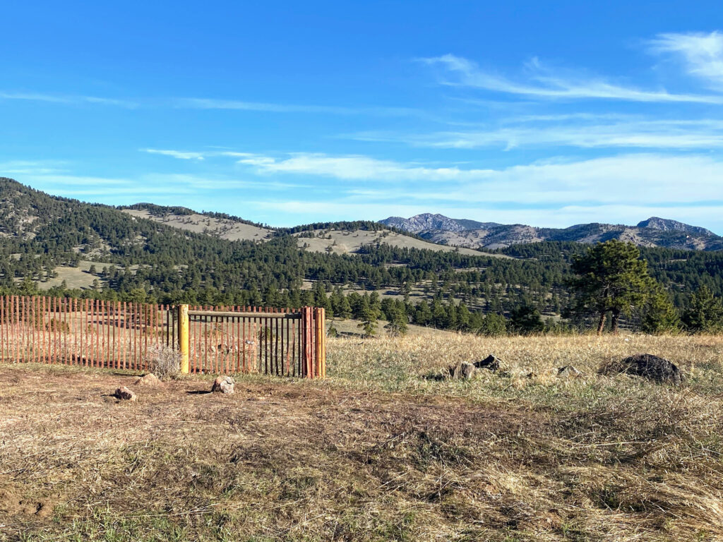
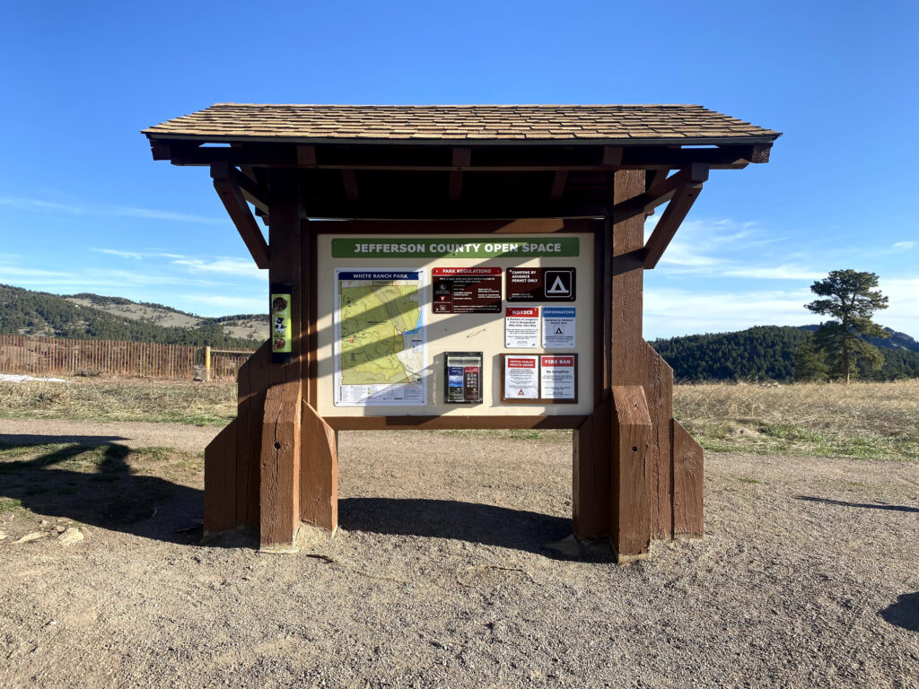
White Ranch Park is a beautiful open space located in Jefferson County, Colorado, just north of Golden. It’s convenient location and proximity to Denver, Boulder, etc., make the park very popular with day hikers and trail runners. Indeed, of all the parks in the Jefferson County Open Space system, White Ranch Park is the largest with 3,953 acres and 21.5 miles of trails. White Ranch Park’s trail network is predominately multi-use, so hikers, trail runners, mountain bikers, and horseback riders all share the trails. For other Jeffco parks, check out our destination reviews on Mount Galbraith Park and North Table Mountain Park.
DESTINATION GUIDE SERIES: white Ranch Park
Why Should You Visit White Ranch Park?
White Ranch Park is only minutes away from downtown Golden and within close proximity to the Denver metro area. Its convenient access and diverse array of trails make it a fantastic day trip destination. Highly popular with trail runners, hikers, and mountain bikers, White Ranch Park has plenty of recreational options and varied terrain for all skill sets. In addition, the park has 20 reservable campsites within two campgrounds (Sawmill and Sourdough Springs). Since camping is only permitted within one other park in the Jefferson County Open Space system, consider reserving campsites well in advance of your visit.


Where is White Ranch Park?
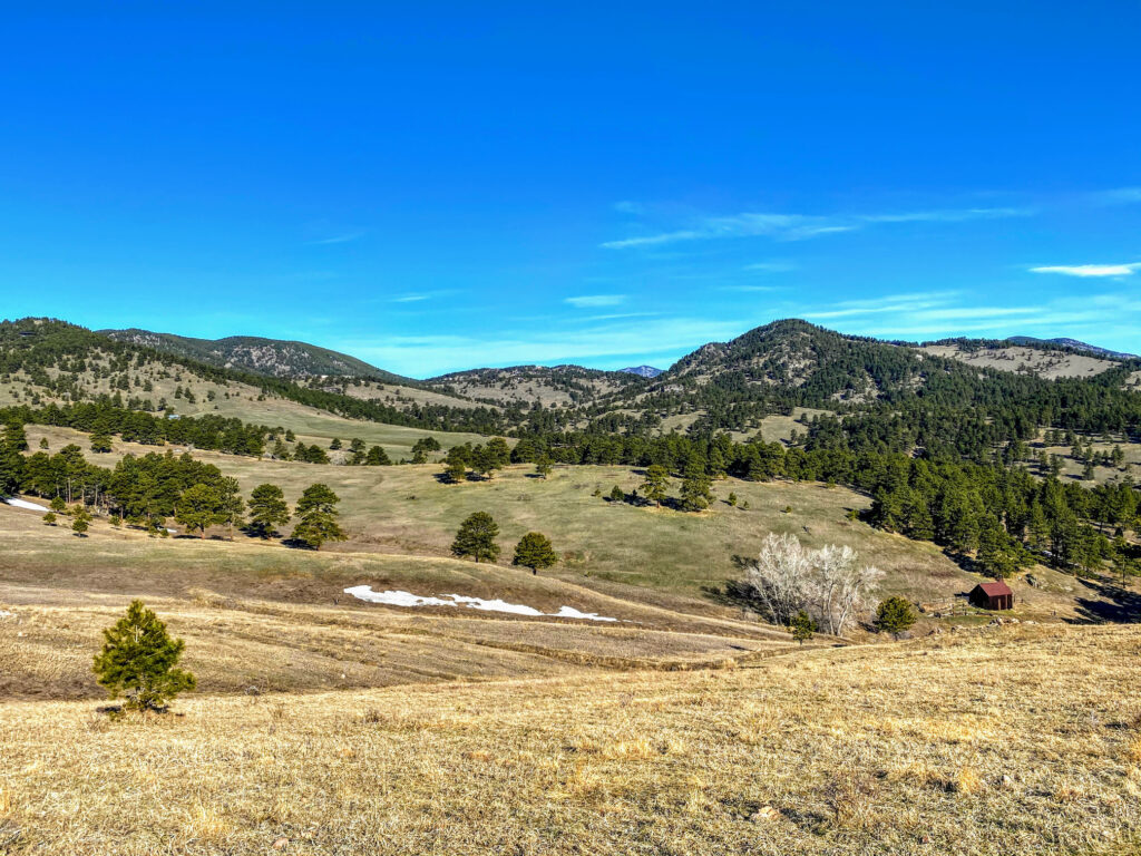
White Ranch Park is located in Jefferson County, north of Golden, CO. The East Trailhead is closest to Golden, just off of Pine Ridge Rd. and West 56th Ave. Alternatively, the West Trailhead is most commonly accessed via Golden Gate Canyon Rd. to Crawford Gulch Rd., with a sharp turn onto Belcher Hill Rd.
Things to Do
Hiking and Trail Running
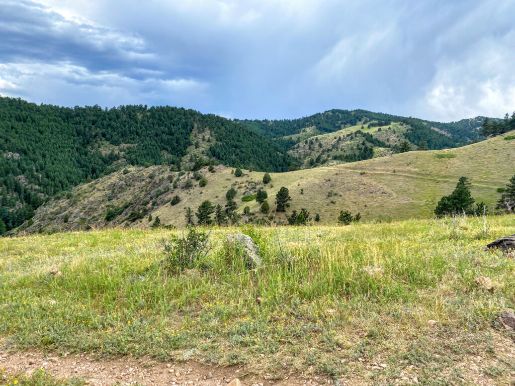
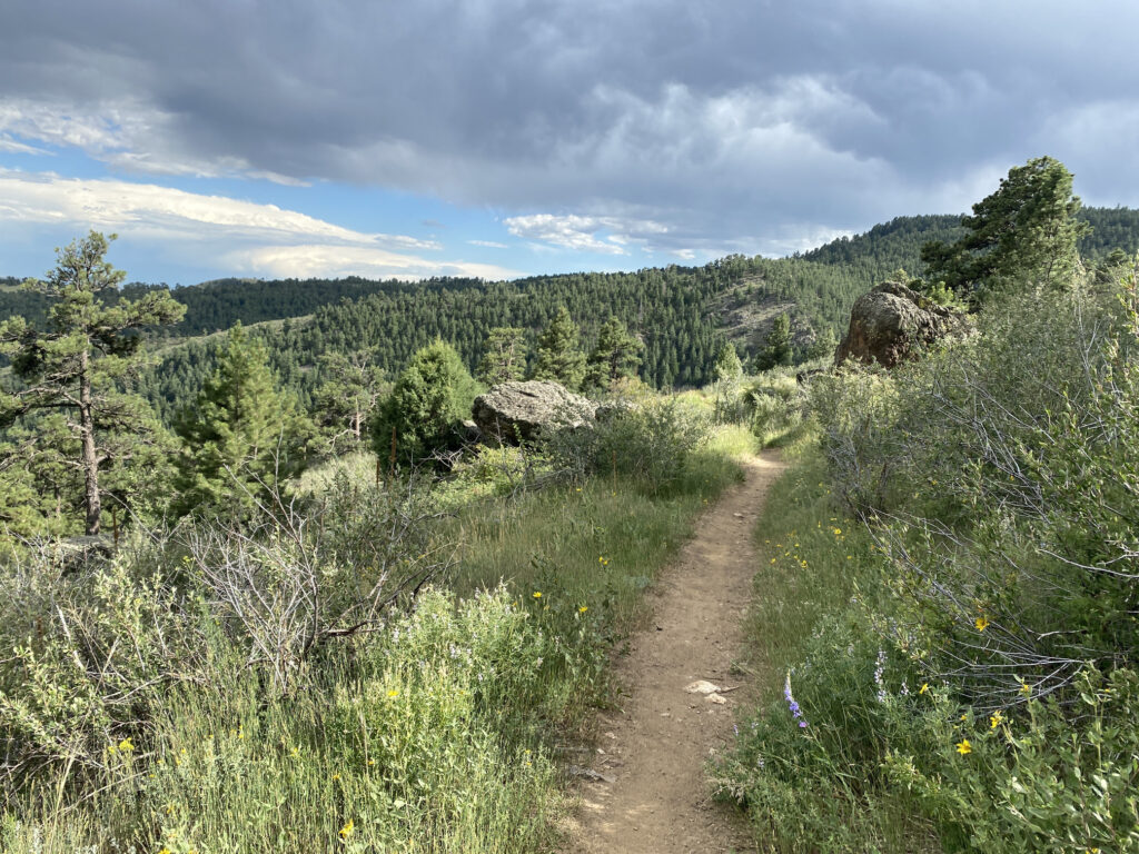
White Ranch Park has an extensive hiking trail network, almost all of which are multi-use trails that share access with horseback riders and mountain bikers. Most trails have multiple intersections with other trails in the park, so making your own loop amongst trail segments is a great option. Check the park map before you go to see whether the East Trailhead or West Trailhead parking lot is most convenient for your hike. Some of the trails below are short branch trails that can add variety and length to a loop hike of your own design.

Belcher Hill Trail
The Belcher Hill Trail is best accessed from the East Trailhead, though it can also be accessed via the overflow parking area near the West Trailhead. At 4.5 miles in length, the majority of the Belcher Hill Trail is rated as “More Difficult,” but about a mile of the trail is “Most Difficult.”
From the East Trailhead parking area, the Belcher Hill Trail begins with about a mile of moderate trail through a park easement. At the intersection with the Whippletree Trail, the Belcher Hill Trail starts to increase inclination. Along the way, visitors will pass numerous intersections of other park trails (e.g., Lower Longhorn, Mustang, Round-up, Sawmill, and Maverick. Thus, the Belcher Hill Trail is an excellent option to use as a starting point and create a loop hike. Visitors that opt to continue all the way to the opposite end of the Belcher Hill Trail for the East Trailhead will eventually connect to the Rawhide Trail.
Rating: More Difficult
Length: 4.5 Miles (one-way)
Use: Multi-Use
Rawhide Trail
Perhaps the premier trail in all of White Ranch Park, the Rawhide Trail is a fantastic loop hike. Best accessed via the West Trailhead, the Rawhide Trail covers much of the park’s northwestern area. Visitors can opt to hike the loop clockwise or counter-clockwise (we prefer counter-clockwise), eventually looping around the Sourdough Springs Campground. The entire Rawhide Trail loop is 5.3 miles, but visitors looking for a shorter loop hike can trim about 3 miles off the hike by using the Wrangler’s Run connector trail.
Check out our comprehensive Rawhide Trail hike review here.
Rating: More Difficult
Length: 5.3 Miles (loop)
Use: Multi-Use
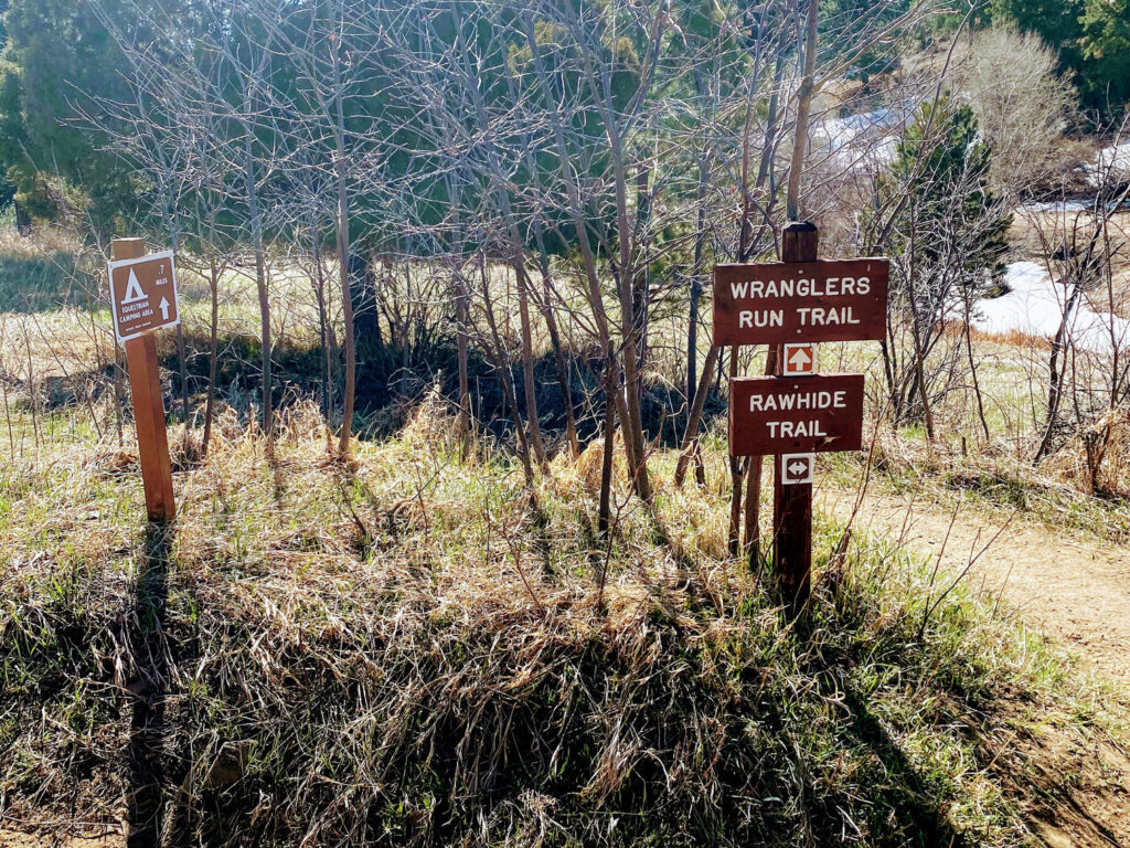
Wrangler’s Run Trail
Wrangler’s Run Trail is a short, .3 mile branch trail that connects opposite sides of the Rawhide Trail. This connector trail is ideal for visitors that prefer a shorter outing, rather than the entire 5.3 mile Rawhide Trail loop. To access the Wrangler’s Run Trail, begin on the Rawhide Trail in a clockwise or counter-clockwise direction. The Wrangler’s Run Trail is about a mile in either direction, and when combined as a loop with the Rawhide Trail, a total of 2.3 miles.
Rating: More Difficult
Length: 0.3 Miles (one-way)
Use: Multi-Use
Mustang Trail
The Mustang Trail is a fairly steep and difficult branch trail that connects with sections of the Belcher Hill Trail. The trail must be accessed via the Belcher Hill Trail near the West Trailhead or from the southern section of the Belcher Hill Trail. At 2.4 miles one-way, this trail is a great addition for a loop hike within the park.
A great, challenging loop hike option, is to start at the beginning of the Belcher Hill Trail via the East Trailhead, hike up Belcher Hill Trail until the intersection with the Mustang Trail, and hike the Mustang Trail for 2 miles until its junction with the Sawmill Trail. Hike along the Sawmill Trail until connecting back with the Belcher Hill Trail and head back towards the East Trailhead parking area. In all, this loop option would be around 8 miles in length.
Rating: Most Difficult
Length: 2.4 Miles (one-way)
Use: Multi-Use

Sawmill Trail
The Sawmill Trail is most immediately accessed via the park’s West Trailhead. From the West Trailhead parking area, the trail covers about .7 miles before intersecting with the Belcher Hill Trail. Visitors can then continue along the Sawmill Trail into the Sawmill Campground area. From the campground, the trail also connects to the Mustang Trail on the opposite side. Thus, visitors that are not camping can use the Sawmill Trail as an opportunity to create a loop hike amongst various trails. This trail is evenly distributed between “Least Difficult” and “More Difficult” ratings.
Rating: More Difficult
Length: 1.4 Miles (one-way)
Use: Multi-Use
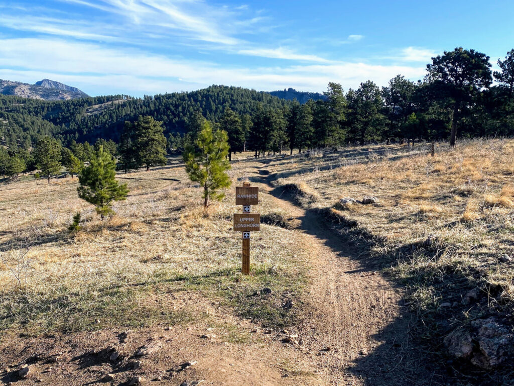
Upper Longhorn Trail
The Upper Longhorn Trail is best accessed via the park’s West Trailhead parking area. This trail links with the Middle Longhorn Trail (bikes only), leading to the Lower Longhorn Trail. Note, however, that since the Middle Longhorn Trail is for bikes only, the Upper Longhorn Trail intersects with the 1.1 mile Shorthorn Trail, which also links to the Lower Longhorn Trail. Visitors have a lot of other route options with the Upper Longhorn Trail, particularly with its linkages to the Rawhide Trail and the Maverick Trail. Thus, the Upper Longhorn Trail is a great starting point to various loop outings.
Rating: More Difficult
Length: 1.1 Miles (one-way)
Use: Multi-Use

Lower Longhorn Trail
As its name implies, the Lower Longhorn Trail is the southern portion of the park’s Longhorn trail network. For the most immediate access to the Lower Longhorn Trail, consider starting on the Belcher Hill Trail via the East Trailhead parking area. The Lower Longhorn Trail ultimately connects with the Shorthorn trail to reach the Upper Longhorn Trail. This trail also connects with the Middle Longhorn Trail section, which is a bike-only trail section.
Rating: Most Difficult
Length: 1.1 Miles (one-way)
Use: Multi-Use
Shorthorn Trail
The Shorthorn Trail connects the Upper Longhorn Trail to the Lower Longhorn Trail. Due to the Middle Longhorn Trail being “bike-only,” the moderately difficult 1.1 mile Shorthorn Trail is an ideal way to connect the Upper and Lower Longhorn Trails and link with the Belcher Hill Trail.
Rating: More Difficult
Length: 1.1 Miles (one-way)
Use: Multi-Use
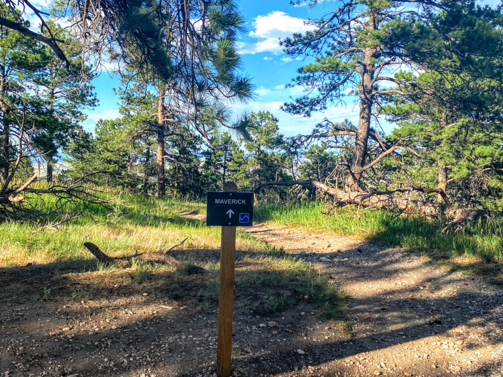
Maverick Trail
The Maverick Trail is a moderately difficult branch trail that connects the Upper Longhorn Trail and a middle portion of the Belcher Hill Trail. This is an ideal branch trail to use to explore the middle portion of White Ranch Park and create a unique loop hike.
Rating: More Difficult
Length: 1.0 Mile (one-way)
Use: Multi-Use
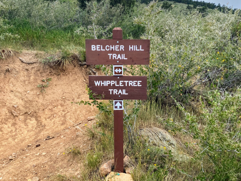
Whippletree Trail
The Whippletree Trail is an easier branch trail that connects the Belcher Hill Trail, Middle Longhorn Trail (bikes only), and Lower Longhorn Trail. From the East Trailhead parking area, the Whippletree Trail is best reached after 1.1 miles of hiking along the easement of the Belcher Hill Trail.
Rating: Least Difficult
Length: 0.6 Miles (one-way)
Use: Multi-Use

Waterhole Trail
The Waterhole Trail is the connector trail that runs through the Sourdough Springs Campground and connects the northern sections of the Rawhide Trail. This trail is used to access campsites or trim a small portion of distance off of the overall Rawhide Trail loop.
Rating: More Difficult
Length: 0.3 Miles (one-way)
Use: Multi-Use

Round-up Trail
The Round-up Trail is a very short (.4 miles) branch trail, which can only be accessed via the middle portion of the Belcher Hill Trail. This is more of a mountain bikers add-on trail, but can certainly be a side trip addition to an outing.
Rating: More Difficult
Length: 0.4 Miles (one-way)
Use: Multi-Use
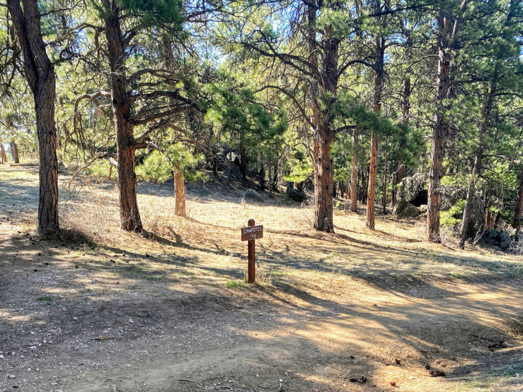
Camping
White Ranch Park has two established, but fairly primitive campgrounds, Sawmill Campground and Sourdough Springs. Both campgrounds have 10 campsites each, are tent-only, and require camping permits. Camping permits via Jefferson County’s reservation system for $12.00/night and must be obtained 24 hours in advance.
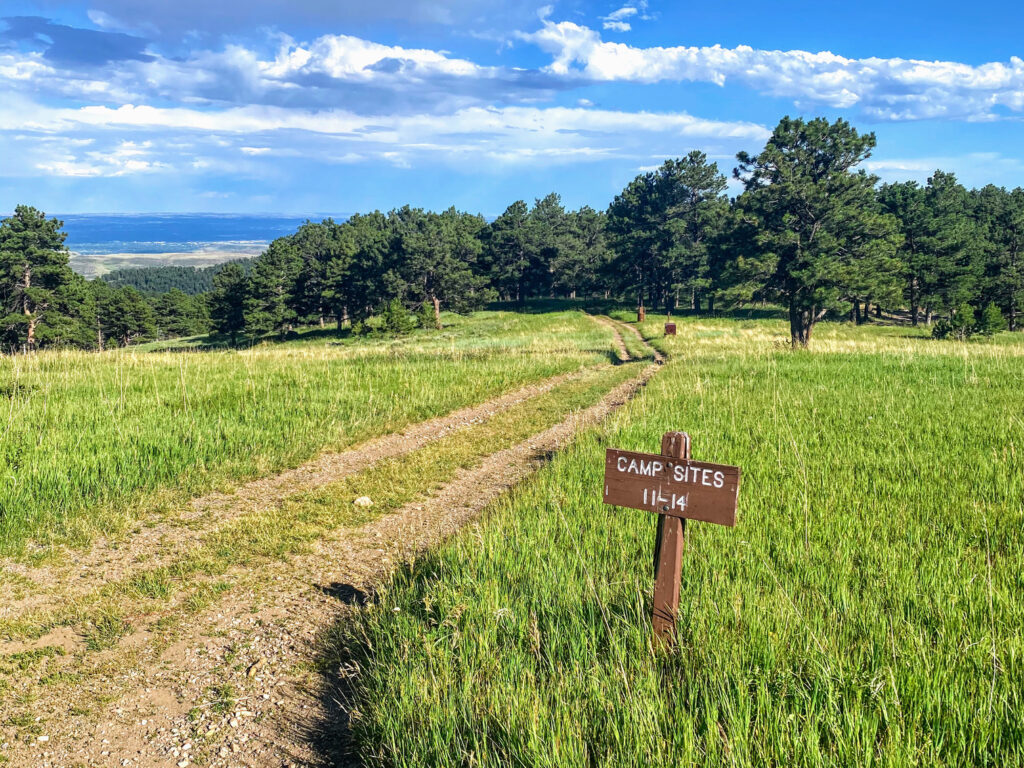
Sawmill Campground
Fees: Campsites are $12.00/night.
The Sawmill Campground has 10 individual campsites, wildlife resistant storage boxes to store food overnight, and a restroom.
Sourdough Springs Campground
Fees: Campsites are $12.00/night.
The Sourdough Springs Campground has 10 individual campsites and is ideal for campers with horses. The campground has a horse corral, horse trough, restroom, and wildlife resistant storage boxes to store food overnight.
Mountain Biking
Mountain biking is permitted on the multi-use trails throughout White Ranch Park’s trail network, which includes nearly all park trails. Note that mountain bikers will share multi-use trails with horseback riders and hikers. The Middle Longhorn Trail segment is a one-way, designated use trail for mountain bikers only and is 0.9 miles long.
Horseback Riding
Horseback riding is permitted on the multi-use trails throughout White Ranch Park’s trail network, which includes nearly all park trails. Riders will share multi-use trails with mountain bikers and hikers. Note that Middle Longhorn Trail is a mountain bike only trail. Also, for horseback riders that opt to camp overnight, Sourdough Springs Campground is an ideal choice since it has a horse trough and corral.
Planning Tips
Fees and Regulations
- Entrance Fees: None.
- Park Hours: Daily; one hour before sunrise to one hour after sunset.
- Pets: Dogs are permitted on trails, but must be on leash.
- Camping: Permits are required; purchase via Jefferson County’s reservation system for $12.00 per night.
Parking
- White Ranch Park has two trailhead parking lots: East Trailhead and West Trailhead. The East Trailhead lot has 51 spaces and the West Trailhead lot has 35 spaces.
Weather Forecast
- Always check the weather forecast before venturing into wilderness. Although White Ranch Park is not at an extremely high elevation, still plan ahead. If the weather is not ideal, plan your trip for another day. Safety first!
Recommended Books
For a well-rounded and more interpretive Colorado Open Space experience, we recommend picking up a few naturalist guides. An easy to use field guide for plants and birds will help identify species and further add to the enjoyment of your time outdoors.
- Saddle Up, Colorado
- Plants of the Rocky Mountains
- Sibley Birds West: Field Guide to Birds of Western North America
- Roadside Geology of Colorado
Disclosure: Please note that this post contains affiliate links. We may receive a small commission if you buy a product or service through an affiliate link. This revenue helps us provide readers with helpful content to plan amazing adventures.
