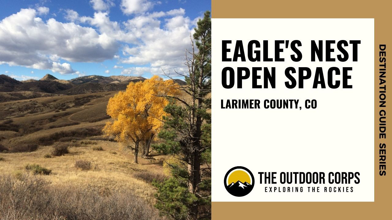
Eagle’s Nest Open Space in Larimer County, CO just northwest of Fort Collins, offers a fantastic alternative to some of the busier Denver area parks. With 755 acres and two trail loops totaling 5.2 miles, Eagle’s Nest is a favorite destination for hikers, horseback riders, and anglers accessing the North Fork of the Cache la Poudre River. As its name implies, Eagle’s Nest Rock, which is the prominent feature in the open space, is home to nesting golden eagles. Eagle’s Nest Open Space is open year-round, but some parts may be seasonally closed due to eagle nesting (so please check ahead). We favor visits here in the autumn, because of cooler temperatures, fewer crowds, and beautiful changing scenery. Dog friendly and great for a day’s worth of adventure, Eagle’s Nest Open Space is a must-visit.
DESTINATION GUIDE SERIES: EagLe’s Nest Open Space
Why Should You Visit Eagle’s Nest Open Space?
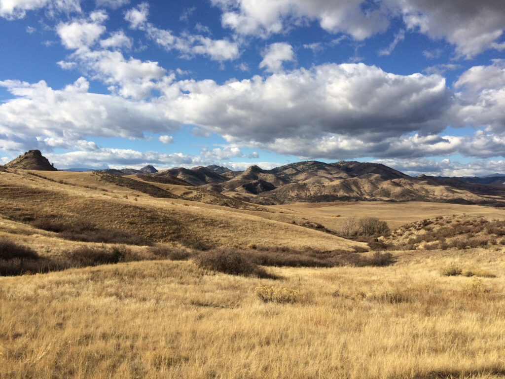
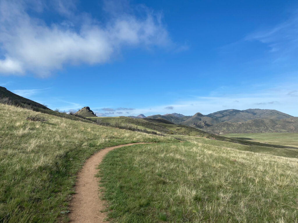
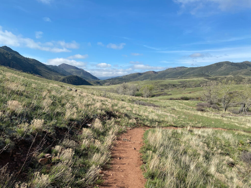
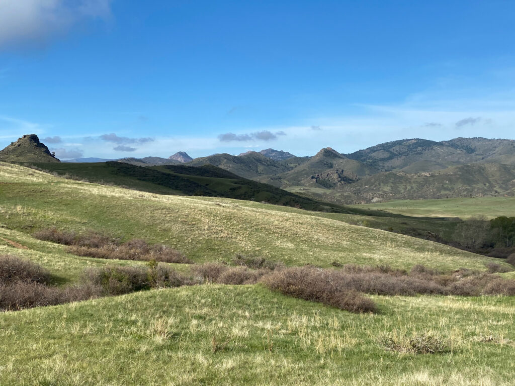
Eagle’s Nest Open Space offers a great change of foothills scenery for those close to the Denver area. Even though it is only a short 30-minute drive from Fort Collins, this open space truly has a remote feeling, coupled with impressive views of the surrounding Laramie foothills. Eagle’s Nest Rock, inhabited by nesting golden eagles, is an incredible landmark itself; but, keep an eye out for other wildlife include deer, elk, coyotes, rattlesnakes, and other raptors.
Eagle’s Nest Open Space’s trail system is straightforward and ideal for beginner-level hikes and trail runs, with modest elevation gain. Indeed, this area is one of our favorite early fall destinations as we wind down a summer of high elevation mountain climbing. Beyond hiking, anglers will appreciate access to the Cache la Poudre River (great for trout fishing), and equestrians have access to trails absent mountain bikes.


Where is Eagle’s Nest Open Space?
Eagle’s Nest Open Space is located in Larimer County, about 30 minutes northwest of Fort Collins, CO and just south of Livermore, CO. Make a sharp turn off of US-287 onto Red Feather Lakes Rd. (W County Rd. 74 E). At the turn off of US-287, you’ll see The Forks Mercantile and Saloon (which is a great spot to pick up a bite to eat after your outing). Turn left off of Red Feather Lakes Rd. onto the open space’s Entrance Road until your reach the parking area.
OPeN Space Trails
Overview
Eagle’s Nest Open Space has two loop trails (3-Bar and OT) that amount to 5.2 miles of total trail length. The 3-Bar Trail is 3.4 miles round-trip and is an excellent loop hike in-and-of itself. However, for those looking to extend their outing, the OT Trail is a separate 1.8 mile round-trip loop hike that is accessible by first hiking a portion of the 3-Bar Trail. Both the 3-Bar and OT Trails are open to hikers, trail runners, and equestrians. In addition, pets on a leash are also permitted. Please note that mountain bikes are not permitted on these trails.
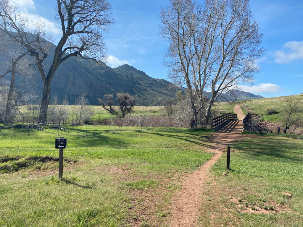
When visiting Eagle’s Nest Open Space, we prefer to combine the 3-Bar and OT Trails together into one big figure-eight loop hike, which provides the fullest perspective of Eagle’s Nest Rock and the area’s incredible ecosystem. Plus, you’ll cross the bridge over the North Fork of the Cache la Poudre River and probably see anglers fishing for trout.

3-Bar Trail
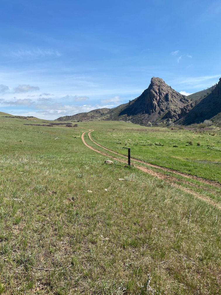
The 3-Bar Trail begins at the Eagle’s Nest Open Space parking area. The trail is well marked along the route with trail posts featuring three horizontal lines (bars), which is a reference to a cattle brand historically used in the area. We prefer to begin this trail in a clockwise direction given the immediate exquisite views of the foothills and an undulating descent toward the North Fork of the Cache la Poudre River. Throughout your descent, you’ll have to pass through a few cattle guard gates. Once your reach the trail connection with the other side of the 3-Bar Trail, you can either continue your clockwise ascent back toward the parking lot or head a bit further to the Cache la Poudre River bridge. If you opt to continue past the bridge, you’ll eventually reach the linkage with the 1.8 mile OT Trail loop.
Rating: Easy
Use: Multi-Use (hiker/runner, equestrian)
Length: 3.4 miles round-trip (3.0 miles + .4 mile connector)
Elevation Gain: 434 ft.

OT Trail
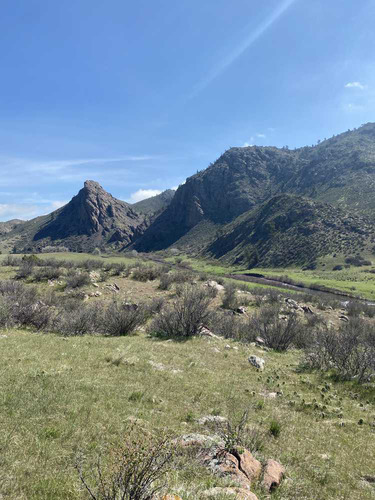
The OT Trail is a 1.8 mile loop within the southern portion of Eagle’s Nest Open Space. Accessed by first hiking a the 3-Bar Trail in a clockwise or counter clockwise direction and crossing the bridge across the North Fork of the Cache la Poudre River, the OT Trail is a pleasant add-on loop. Trail posts with “OT” mark the route, with OT being another reference to a local historical cattle brand. As this the OT Trail is a loop, you can start the trail in either direction, but we prefer counter-clockwise in this case. This direction will provide for a fantastic view of Eagle’s Nest Rock as you complete the loop alongside the river. Once you’ve completed the loop, reconnect with the 3-Bar Trail, cross the bridge again, and ascend the remainder of the 3-Bar Trail towards the parking lot.
Rating: Easy
Use: Multi-Use (hiker/runner, equestrian)
Length: 1.8 miles (round-trip)
Elevation Gain: 230 ft.
Planning Tips
Fees and Regulations
- Entrance Fees: None.
- Park Hours: Day use only; closed sunset to sunrise.
- Pets: Permitted; must be kept on leash.
- Camping: Not permitted.
- Bikes: Not permitted.
- Rock Climbing: Not permitted.
Parking
- Eagle’s Nest Open Space has ample parking, but it does fill up quickly on nice weekend days. The entrance gate opens and closes automatically according to the park’s ‘dusk-to-dawn’ operating hours, so plan your arrival/departure accordingly. A restroom is located in the parking area.
Weather Forecast
- Always check the weather forecast before venturing into wilderness. Eagle’s Nest Open Space is at an elevation of approximately 6,000ft. Plan ahead and pack according to forecasted weather conditions.
Recommended Books
For a well-rounded and more interpretive Colorado Open Space experience, we recommend picking up a few naturalist guides. An easy to use field guide for plants and birds will help identify species and further add to the enjoyment of your time outdoors. In addition, there are a few Fort Collins area hiking guides that offer more details on nearby trails.
If you’re looking for even more Rocky Mountain adventures, don’t forget to also check out our other Destination Guides here for things to do!
- Prairie, Peak, and Plateau: A Guide to the Geology of Colorado
- Roadside Geology of Colorado
- Guide To Colorado Wildflowers: Plains and Foothills
- Plants of the Rocky Mountains
- Trees of Colorado Field Guide
- Sibley Birds West: Field Guide to Birds of Western North America
- Colorado Rocks & Minerals: A Field Guide to the Centennial State
- Hikes Around Fort Collins
- Best Easy Day Hikes Fort Collins
Disclosure: Please note that this post contains affiliate links. We may receive a small commission if you buy a product or service through an affiliate link. This revenue helps us provide readers with helpful content to plan amazing adventures.

