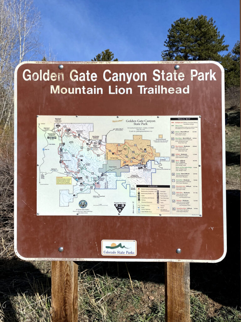
The Mountain Lion Trail in Colorado’s Golden Gate Canyon State Park is one of the premier trails within the entire park. At 6.7 miles in length and designated “Difficult” by Colorado Parks and Wildlife, the Mountain Lion Trail is a fairly challenging loop hike, but not overly intense. Given the trail’s proximity to the Denver metro, this is a great day hike or trail run option for a weekend excursion.
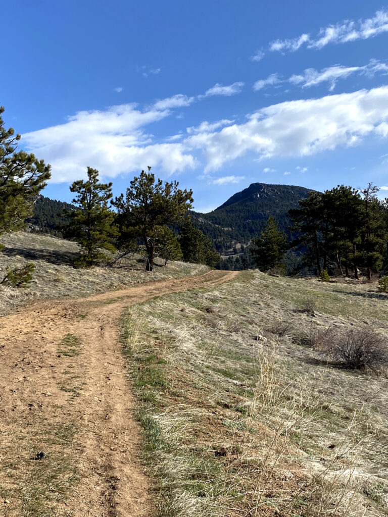
Indeed, the diverse terrain of the Mountain Lion Trail is stunningly beautiful, with expansive views of nearby foothills, vistas of Front Range mountains, dense forest, and peaceful Deer Creek crossings. You can also opt to tack on a side trip to the summit of Windy Peak if you’re inclined. With or without Windy Peak, we think the Mountain Lion Trail is a true gem and one not to be missed.
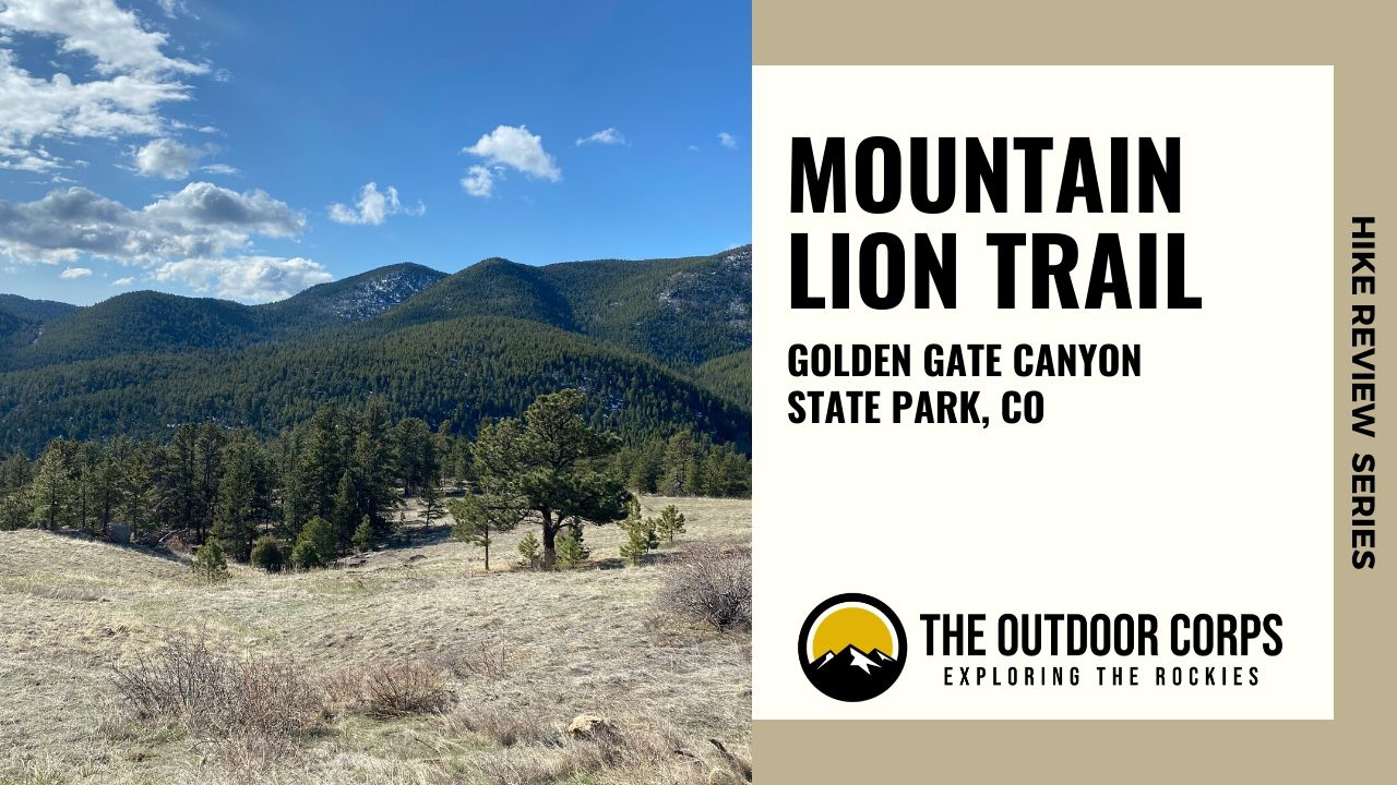
HIKE REVIEW SERIES: MOUNTAIN LION TRAIL
Mountain Lion Trail Guide
Route Information
- Round Trip Distance: 6.7 Miles
- Elevation Gain: 1,230 ft.
- Trail Type: Loop
- Trailhead: Mountain Lion Trailhead
- Coordinates: 39.850727, -105.360385
- Dogs Permitted?: Yes, on leash

Route Instructions


- Step 1 - Park at the Nott Creek Parking Area, which is down a service road adjacent to the Red Barn Group Picnic Area. If you haven’t paid the park entrance fee ($9.00), there is a self-pay station at the entrance of the service road.
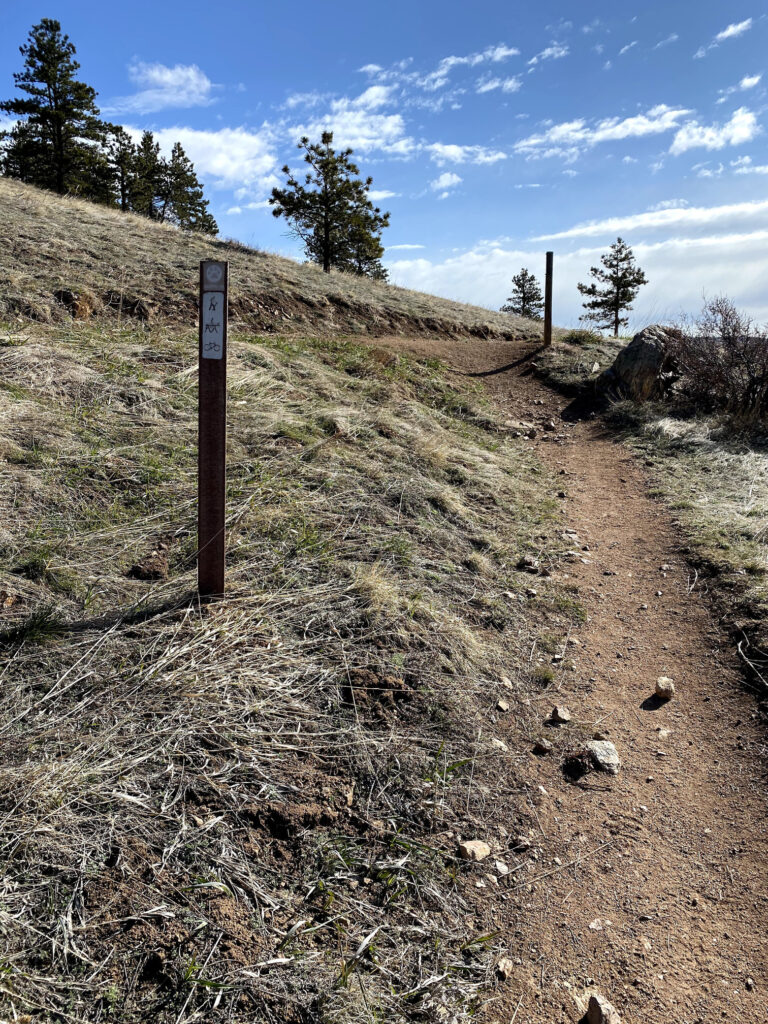
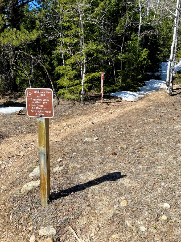
- Step 2 - Beginning the trail in a counter-clockwise direction, start on the Mountain Lion Trail and pass the parking area restrooms. The trail will start to slightly incline. Metal stakes with a mountain lion paw icon clearly mark the trail along the route, indicating you’re on the right track.
- Step 3 - You’ll reach a dirt service road in about .5 miles. Bear slightly to the right on this road to stay on the Mountain Lion Trail. Blue Mountain will become visible directly ahead.
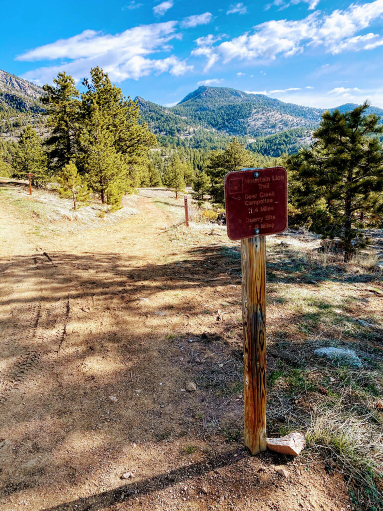
- Step 4 - The Mountain Lion Trail splits off of the service road, with signs indicating distances to the Quarry Site (.9 miles) and Deer Creek Campsites (1.4 miles). Bear slightly right to stay on the Mountain Lion Trail.
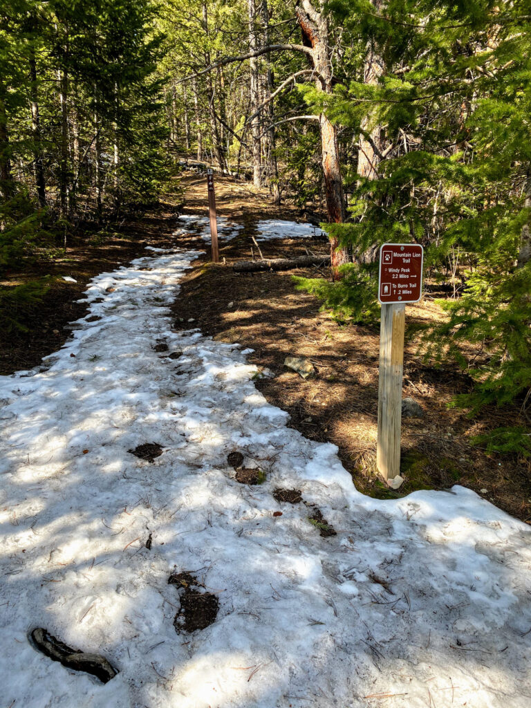
- Step 5 - You’ll eventually reach a Deer Creek footbridge crossing. Signage will indicate distance to the Quarry Site (.6 miles to the right) and Windy Peak (2.8 miles to the left). Turn left in the direction of Windy Peak.
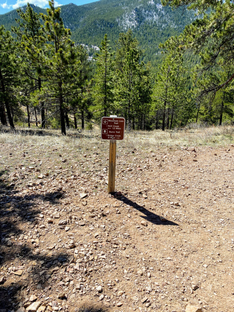
- Step 6 - As the trail continues into more dense forest, you’ll pass some backcountry campsites and a shelter, then reach the junction with the Burro Trail. Make sure to follow the Mountain Lion Trail towards Windy Peak (2.2 miles from this point).
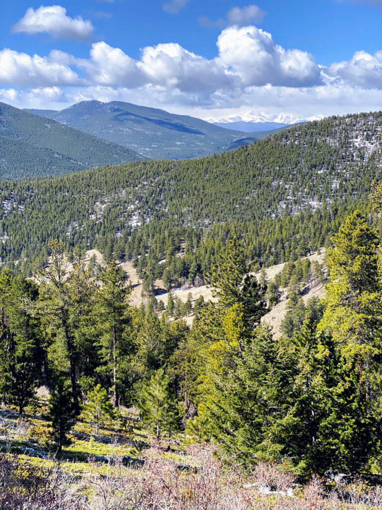
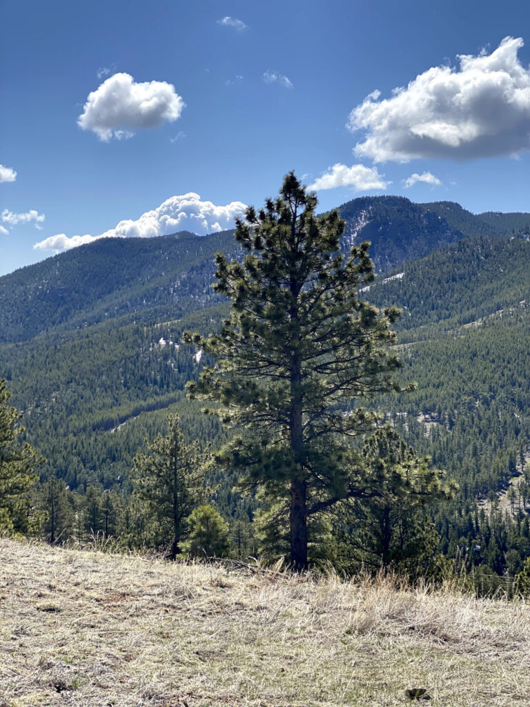
- Step 7 - You’ll cross Deer Creek a number of times and continue to increase elevation gain as you head up the trail. As you exit the dense forest, you’ll soon see a vista of Front Range mountains, including Mount Evans and Mount Bierstadt.
- Step 8 - The trail will start to head downhill, towards the Forgotten Valley. You’ll reach a junction with the Buffalo Trail, but continue to Forgotten Valley (which is .2 miles from this point).
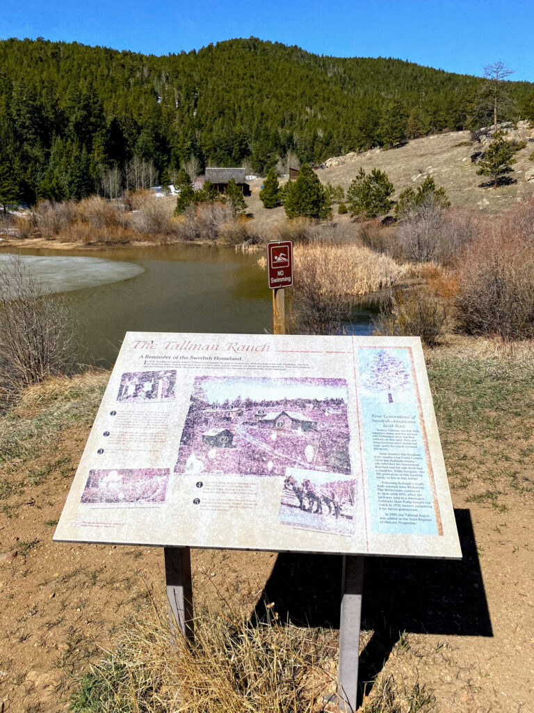
- Step 9 - Once in the Forgotten Valley, you’ll reach a pond and the Tallman Ranch, which was a homestead in the 19th century. The ranch is now preserved as a historic property.
- Step 10 - Continue along the Mountain Lion Trail, back towards Nott Creek. You’ll eventually reach the junction with the City Lights Ridge Trail. A side excursion here is about one-mile, round trip.
- Step 11 - Following the Mountain Lion Trail further along, you’ll again pass intersections with the Burro Trail. Be sure to continue along the Mountain Lion Trail to head back to the trailhead.
- Step 12 - As you hike the remaining portion of the Mountain Lion Trail, you’ll see exceptional views of evergreen forested foothills.
- Step 13 - End the hike back at the Nott Creek Parking Area. Enjoy the rest of the day and reminisce on the great hike you just accomplished!
PLANNING TIPS
Regulations
- Park Hours: 5:00 AM – 10:00 PM
- Pets: Dogs are permitted on the trail, but must be on leash.
- Camping: Backcountry campers must purchase a first-come, first-served permit at the Visitor Center. Backcountry camping permits are $18.00.
- Fishing: Fishing in the park requires a Colorado fishing license. If you do not have fishing license, stop by the Visitor Center to purchase one or buy one online here.
Entrance Fees
- Daily Vehicle Pass: $10.00 – Purchase day of visit. Remember to bring exact change if you opt to use any of the self-service pay stations found around the park. Alternatively, the Visitor Center will accept credit card payments during their operating hours.
- Affixed State Park Pass: $80.00 – This pass is good for 12 months of unlimited access to Colorado state parks. The pass is not interchangeable between vehicles.
- Hang Tag Park Pass: $120.00 – This pass is good for 12 months of unlimited access to Colorado state parks. The pass is interchangeable between vehicles.
Getting There
Golden Gate Canyon State Park is located within Gilpin and Jefferson counties, less than 30 miles from Denver and about 15 miles from Golden.
From Golden Gate Canyon Road, turn on to Crawford Gulch Road. The Visitor Center is immediately on the right. Continue down Crawford Gulch, which eventually turns into Drew Hill Road, for about 3.5 miles. As you near the Red Barn Group Picnic Area, you’ll see a service road that will take you to the Nott Creek Trailhead parking area.
Parking
Park at the Nott Creek Parking Area. There are plenty of spots at the trailhead, but they fill up quickly on nice weekends. Restroom near trailhead.
Cell Phone Reception
There is limited to no cell coverage in Golden Gate Canyon State Park.
Weather Forecast
Always check the weather forecast before venturing into wilderness. Although Golden Gate Canyon State Park is not at an extremely high elevation, still plan ahead. If the weather is not ideal, plan your trip for another day. Safety first!
RECOMMENDED HIKING APPAREL AND GEAR
Ten Essentials
Even on a day hike, you should carry the appropriate type and amount of gear, clothing, food, water, and other essentials. For certain, make sure that your packing list includes the Ten Essentials.
Hiking Boots
The Merrell Moab hiking boot lineup offers a good balance between weight and foot protection. These are great for scrambles and are constructed with waterproof membranes so you don’t have to worry about damp feet if the weather turns or you have to splash through streams or puddles along the way.


Hiking Pants
We love prAna’s hiking pants for their quality and versatility. Indeed, their Zion (for men) and Halle (for women) are great on- and off-trail, especially for travel. Constructed with a durable UPF-50 fabric, a water-repellant finish, and utility pockets, these have become a staple in our wardrobe. Remember that it can be rather chilly at alpine elevations, so consider hiking pants rather than shorts (both for warmth and sun protection).


Base Layer Shirt
Patagonia’s lineup of capilene base layer t-shirts are lightweight and moisture wicking. For our hiking t-shirts and base layers, we often turn to Patagonia products for their craftsmanship, durability, and comfort. Patagonia Capilene Cool Lightweight shirts are versatile and great for hiking and/or trail running.


Hiking Fleece
Depending upon the time of year (and time of day), a fleece hoody or jacket may come in handy. We like the Patagonia R1 as a midweight, but light, option for chilly morning starts. Available as a hoody or jacket, the Patagonia R1 is quick drying, breathable, and extremely comfortable.


Hiking Socks
For most of our hiking needs, we like Darn Tough socks over the multitude of options on the market. They last long and have an ironclad guarantee. In addition, Darn Tough has a variety of designs, ankle lengths, and cushioning options to choose from. We like the Hiker quarter length with light cushioning.


Headwear/Face Covering
We often wear a Buff as a neck gaiter to protect from the sun, given its UPF 50 protective construction. Buffs are also a great option to use as a face covering on the trail. In fact, there are 12+ ways of wearing a Buff, so it’s a versatile piece of gear.

Day Pack
If you’re on the Mountain Lion Trail for a day hike or quick trail run, consider a super lightweight hydration vest. Nathan's Hydration Vests are minimalist packs with reasonable storage capacity and hydration reservoir compatibility.

Sunscreen
Sun Bum is our go-to sunscreen nowadays. We like its non-greasy feel and neutral fragrance. Any quality sunscreen will do, but Sun Bum SPF 30 is our choice for long days in the sun.

Trail Snacks
Taos Bakes, made in New Mexico, are some of the best tasting energy bars out there. Vegan and gluten-free, these bars pack in a nice dose of fiber and protein along with a touch of sweetness. Available in multiple varieties, such as Toasted Coconut/Vanilla Bean, Piñon Coffee/Dark Chocolate, and Pecan Praline/Maple Syrup.

Recommended books
If you intend to visit more Colorado state parks beyond Golden Gate Canyon, “Colorado State Parks: A Complete Recreation Guide,” though a bit dated, does a nice job providing general overviews of the parks. In addition, we recommend picking up a few naturalist guides for general awareness of the area. An easy to use field guide for plants and birds will help identify species and further add to the enjoyment of your outdoors experience.
- Colorado State Parks: A Complete Recreation Guide
- Plants of the Rocky Mountains
- Sibley Birds West: Field Guide to Birds of Western North America
- Roadside Geology of Colorado
Disclosure: Please note that this post contains affiliate links. We may receive a small commission if you buy a product or service through an affiliate link. This revenue helps us provide readers with helpful content to plan amazing adventures.