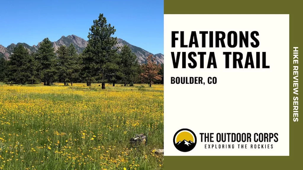
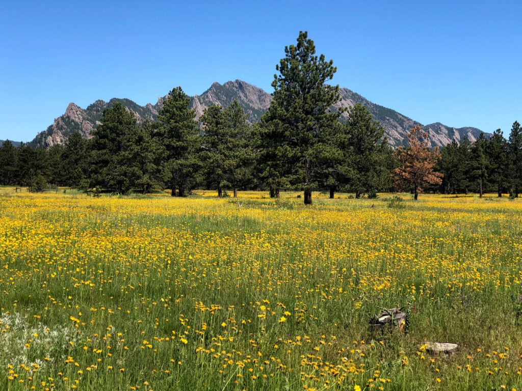
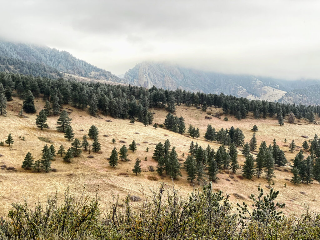
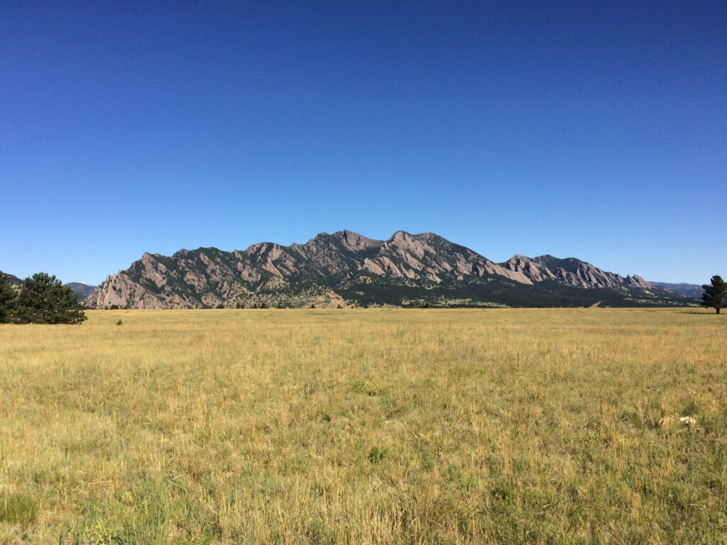
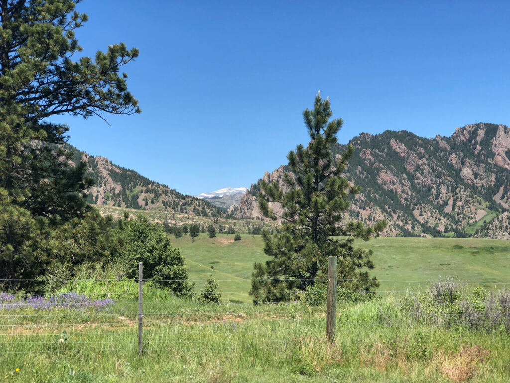
The Flatirons are immediately recognizable conglomeratic sandstone rocks formed as part of the Fountain Formation nearly 300 million years ago. Somewhere between 35-80 millions years ago, these formations began to uplift and tilt into the rugged appearance that make the Flatirons unique. Indeed, the Flatirons are so iconic, they even appear on Boulder’s official city seal! An ideal way to enjoy the Flatirons is via the Flatirons Vista Trail, a fairly straightforward and relatively easy 3.5 mile loop hike only a short distance from Denver and downtown Boulder.
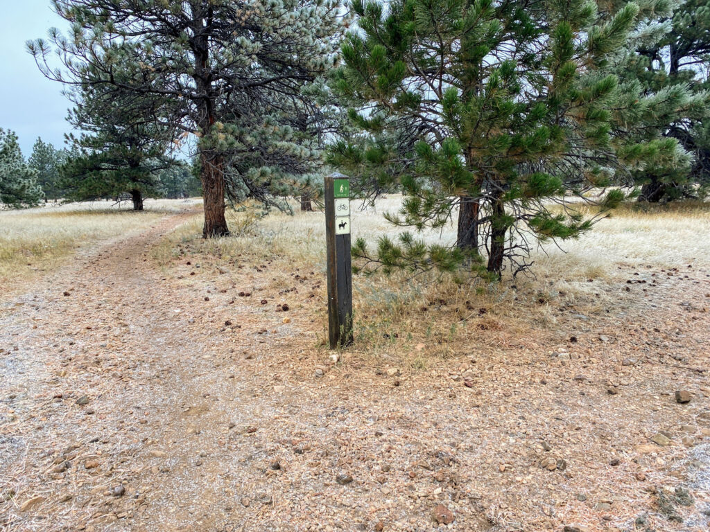
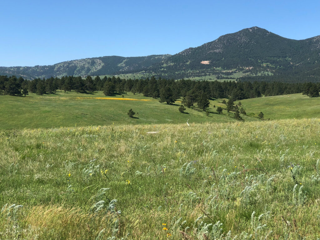
Unbelievably picturesque views of the Flatirons and expansive meadows teeming with ground nesting birds (e.g., Western Meadowlark, Horned Lark, Vesper Sparrow, Killdeer) make the Flatiron Vista Trail a popular year-round trail. Because the trail is multi-use, you’ll often share the loop with hikers, trail runners, mountain bikers, and equestrians. Enjoy the Flatirons!
HIKE REVIEW SERIES: Flatirons Vista TRAIL
Flatirons Vista Trail Guide
Route Information
- Round Trip Distance: 3.5 miles
- Elevation Gain: 257 ft.
- Trail Type: Loop
- Trailhead: Flatirons Vista
- Coordinates: 39.924160, -105.235296
- Dogs Permitted?: Yes

Route Instructions
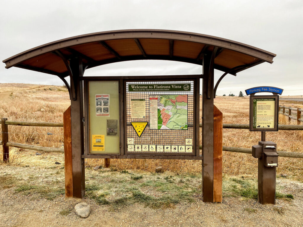

- Step 1 - Park at the Flatirons Vista Trailhead, located off of CO-93. If you don’t have a Boulder Open Space and Mountain Parks annual parking permit, there is a self-pay station at the entrance ($5.00, cash fee).
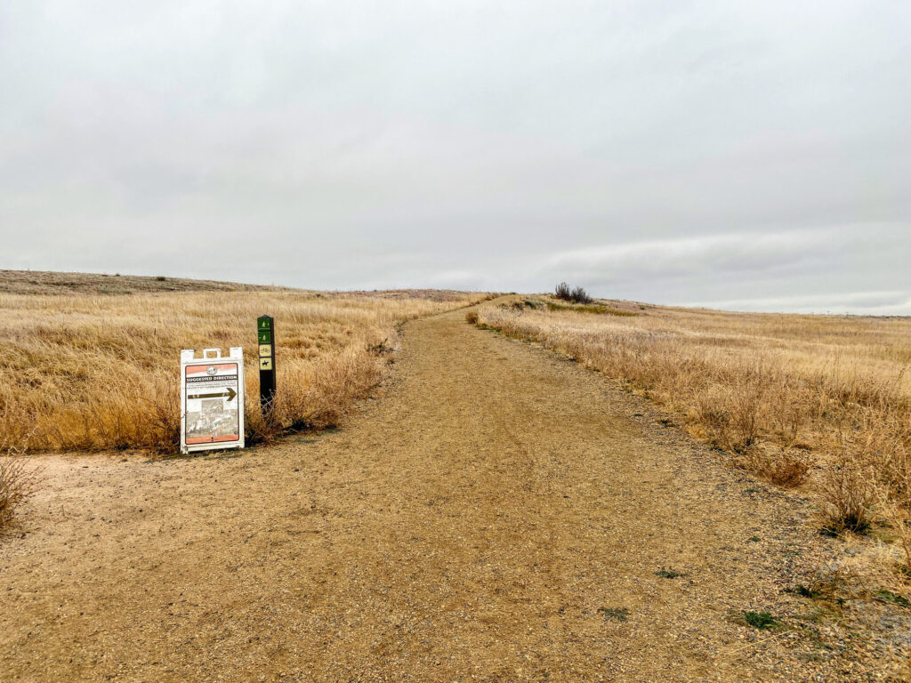
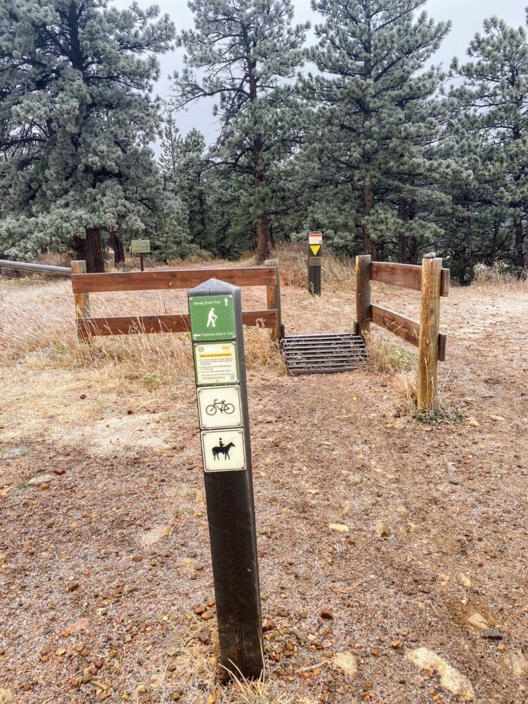
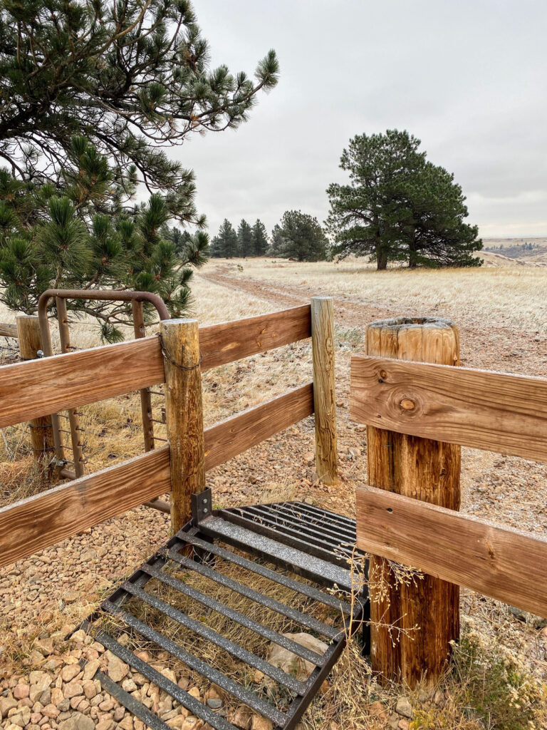
- Step 2 - Enter through the cattle guard gate at the trailhead and begin the Flatirons Vista Trail via the recommended counter-clockwise direction. Note that the Prairie Vista Trail also begins here, so be sure to bear right onto the Flatirons Vista Trail.
- Step 3 - The trail will parallel with CO-93 for a few hundred feet. You’ll pass a connector trail on your righthand side that starts from the Greenbelt Plateau Trailhead. Bear left to stay on the trail towards the Flatirons.
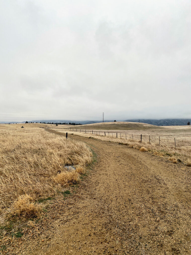
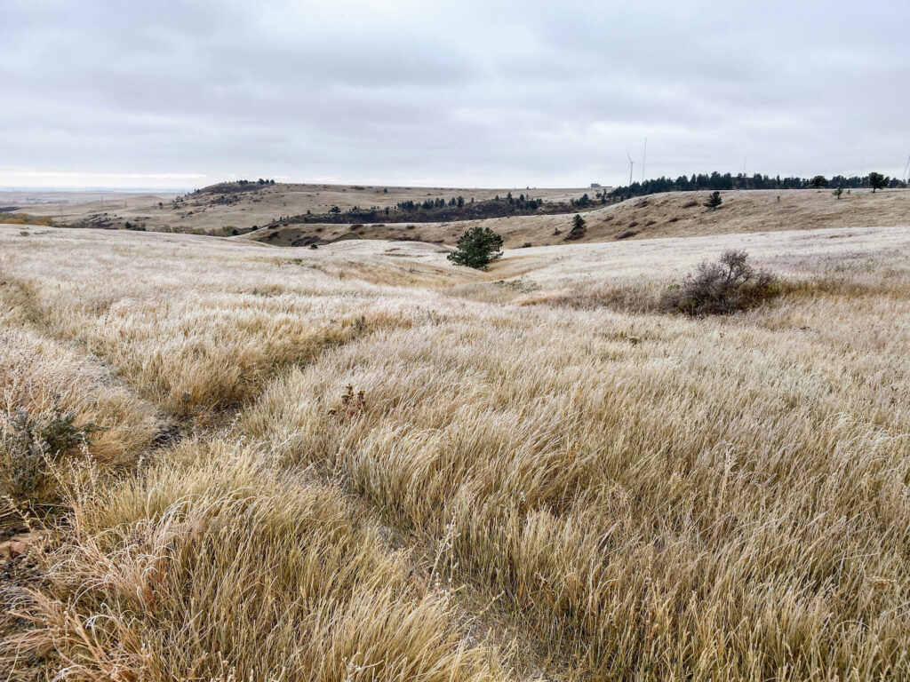
- Step 4 - You’ll again meet an intersection with the Prairie Vista Trail on your left. Stay on the Flatirons Vista Trail (north), which slightly inclines and continues towards the Flatirons. Beautiful meadow views will be to your left and right. These meadows are filled with an abundance of prairie dogs and ground nesting birds.
- Step 5 - After about another mile, you will reach the junction with the Doudy Draw Trail. Continue on the Flatirons Vista Trail (south) by bearing slightly to the left.
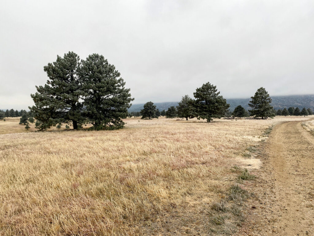
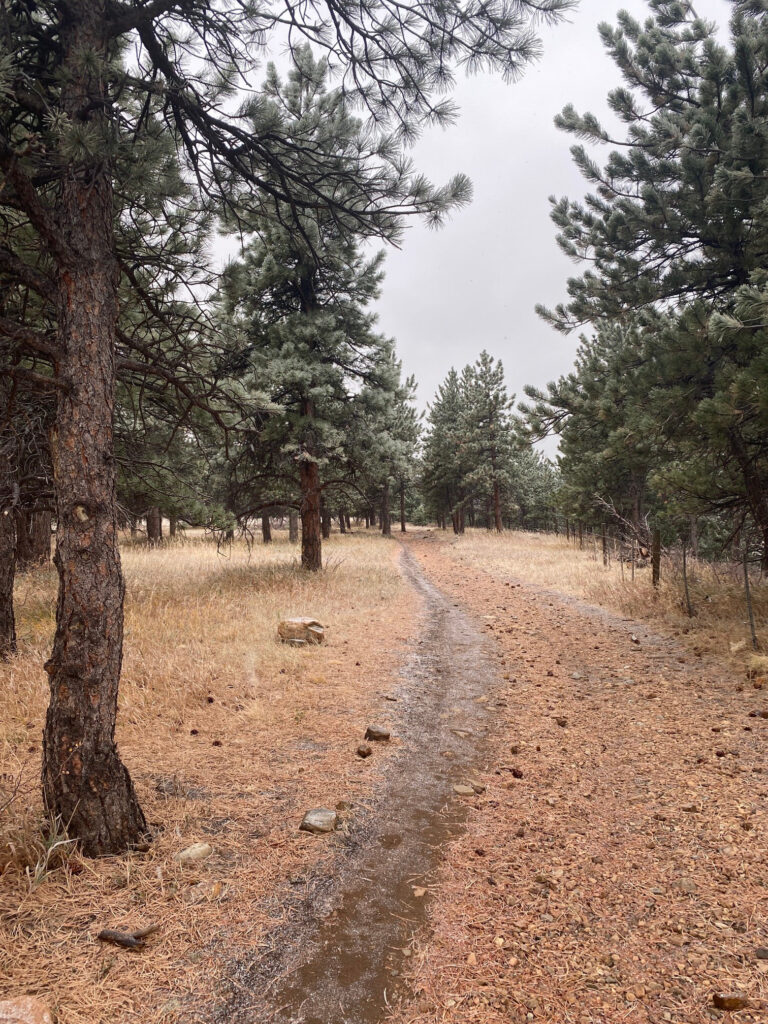
- Step 6 - The trail enters a ponderosa pine forested section for about a half mile. The majority of this loop is open meadow, so the shade here during the hot days of summer offers an opportunity for a rest.
- Step 7 - As you round the loop in towards the end of the forested section, be sure to check out the views of the meadows and Flatirons to your righthand side.
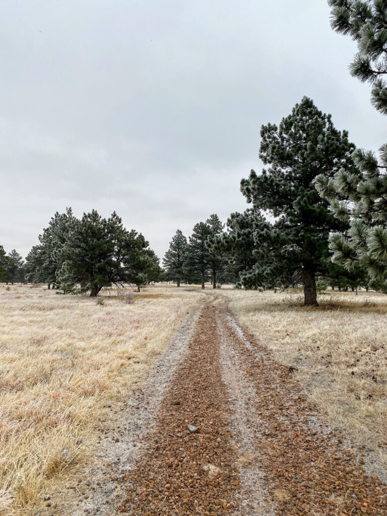
- Step 8 - The trail opens back to meadows with the occasional ponderosa pine. In the springtime, this area is filled with wildflowers.
- Step 9 - You’ll eventually reach a cattle guard gate (one of a few on this hike) and you’ll start to head back towards CO-93 and the trailhead parking area.
- Step 10 - You’ll reach another junction with the Prairie Vista Trail on your left. Continue along the Flatirons Vista Trail.
- Step 11 - The meadow starts to open even further with less ponderosa trees on both sides. Don’t forget to turn around and look back towards the Flatirons every now and then for a different viewing perspective.
- Step 12 - The trail passes a pond to the left side and again crosses the Prairie Vista Trail. At this intersection, turn right towards the parking area.
- Step 13 - End the hike back at the Flatirons Vista Trailhead parking area. Enjoy the rest of the day and reminisce about the fantastic Flatirons views!
PLANNING TIPS
Regulations
- Parking Lot Hours: Closed between 11:00pm – 5:00am.
- Pets: Permitted on leash; or registered in Voice/Sight Control Program, with tags.
- Bikes: Permitted.
- Horseback Riding: Permitted. Please refer to regulations here.
- Camping: Not permitted.
- Leave No Trace: Please stay on designated trails and pack out any trash/dog waste.
Getting There
From Denver, take US-6 W/6th Ave. towards Golden. The road eventually turns into CO-93 N. Continue straight on CO-93 N for about 12 miles and the Flatirons Vista Trailhead parking area will be on the left, marked with an “Open Space & Mountain Parks” sign.
Parking
The trailhead parking lot is just off CO-93 (S Foothills Parkway) and has approximately 40 parking spots, including oversize vehicle parking. A restroom is located at the trailhead.
Visitors with vehicles not registered in Boulder County must have a daily or annual Boulder Open Space and Mountain Parks (OSMP) permit to park at the Flatirons Vista Trailhead. A daily parking permit is $5.00 (cash, exact change) and can be purchased at the fee station near the trailhead. If you plan to visit other Boulder OSMP trails, consider investing in an annual parking permit for $25.00 + a small service fee.
Weather Forecast
The Flatirons Vista trailhead is at an elevation of ~5,900 ft. Always check the weather before heading out on the trail, regardless of how easy a hike may be. This trail is accessible year-round and is good option in the fall/winter.
RECOMMENDED HIKING APPAREL AND GEAR
Ten Essentials
Even on a day hike, you should carry the appropriate type and amount of gear, clothing, food, water, and other essentials. For certain, make sure that your packing list includes the Ten Essentials.
Hiking Boots
The Merrell Moab hiking boot lineup offers a good balance between weight and foot protection. These are great for scrambles and are constructed with waterproof membranes so you don’t have to worry about damp feet if the weather turns or you have to splash through streams or puddles along the way.


Hiking Pants
We love prAna’s hiking pants for their quality and versatility. Indeed, their Zion (for men) and Halle (for women) are great on- and off-trail, especially for travel. Constructed with a durable UPF-50 fabric, a water-repellant finish, and utility pockets, these have become a staple in our wardrobe. If you intend to hike, consider hiking pants rather than shorts (both for warmth and sun protection).


Base Layer Shirt
Patagonia’s lineup of capilene base layer t-shirts are lightweight and moisture wicking. For our hiking t-shirts and base layers, we often turn to Patagonia products for their craftsmanship, durability, and comfort. Patagonia Capilene Cool Lightweight shirts are versatile and great for hiking and/or trail running.


Hiking Fleece
Depending upon the time of year (and time of day), a fleece hoody or jacket may come in handy. We like the Patagonia R1 as a midweight, but light, option for chilly morning starts. Available as a hoody or jacket, the Patagonia R1 is quick drying, breathable, and extremely comfortable.


Hiking Socks
For most of our hiking needs, we like Darn Tough socks over the multitude of options on the market. They last long and have an ironclad guarantee. In addition, Darn Tough has a variety of designs, ankle lengths, and cushioning options to choose from. We like the Hiker quarter length with light cushioning.


Headwear/Face Covering
We often wear a Buff as a neck gaiter to protect from the sun, given its UPF 50 protective construction. Buffs are also a great option to use as a face covering on the trail. In fact, there are 12+ ways of wearing a Buff, so it’s a versatile piece of gear.

Day Pack
If you’re on the Flatirons Vista Trail for a day hike or quick trail run, consider a super lightweight hydration vest. Nathan's Hydration Vests are minimalist packs with reasonable storage capacity and hydration reservoir compatibility.

Sunscreen
Sun Bum is our go-to sunscreen nowadays. We like its non-greasy feel and neutral fragrance. Any quality sunscreen will do, but Sun Bum SPF 30 is our choice for long days in the sun.

Trail Snacks
Taos Bakes, made in New Mexico, are some of the best tasting energy bars out there. Vegan and gluten-free, these bars pack in a nice dose of fiber and protein along with a touch of sweetness. Available in multiple varieties, such as Toasted Coconut/Vanilla Bean, Piñon Coffee/Dark Chocolate, and Pecan Praline/Maple Syrup.

Recommended books
We recommend picking up a few naturalist guides for general awareness of Colorado geology, plants, and local wildlife. Particularly because the Flatirons Vista Trail has an abundance of ground nesting birds and it is common to see other wildlife during an outing, an easy to use field guide will help identify species and further add to the enjoyment of your outdoors experience.
- Sibley Birds West: Field Guide to Birds of Western North America
- American Birding Association Field Guide to the Birds of Colorado
- Mammals of Colorado Field Guide
- Plants of the Rocky Mountains
- Roadside Geology of Colorado
- Boulder Hiking Trails, 5th Edition: The Best of the Plains, Foothills, and Mountains
- Best Trail Runs Denver, Boulder & Colorado Springs
Disclosure: Please note that this post contains affiliate links. We may receive a small commission if you buy a product or service through an affiliate link. This revenue helps us provide readers with helpful content to plan amazing adventures.