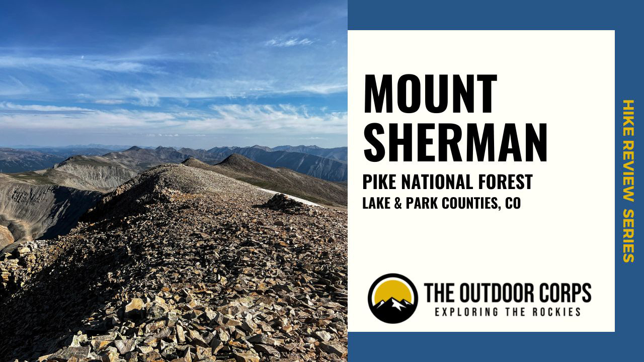
Mount Sherman (14,036ft.) is a 14er mountain located in Colorado’s Mosquito Range, within the Pike National Forest (though the mountain itself is on a private mining claim, hiking is permitted). Split between Park and Lake counties, Mount Sherman can be easily accessed via the towns of Fairplay or Leadville.
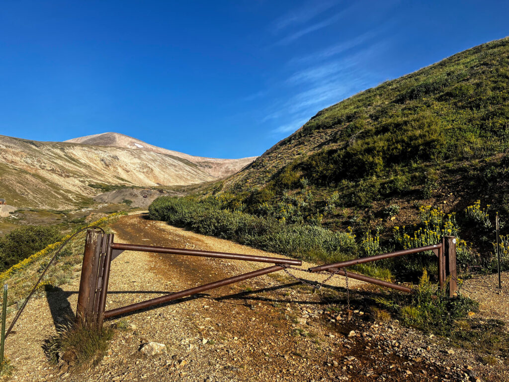
The standard Mount Sherman approach via the Southwest Ridge is accessed from Fairplay and begins at the Fourmile Creek Trailhead gate on County Road 18. From this starting point, a roundtrip hike of Mount Sherman is a mild 4.8 miles and a relatively mellow 1,800+ feet of elevation gain. The Southwest Ridge route is mostly Class 1 with the exception of some Class 2 scrambling to reach the summit. Considered one of the easier 14er mountains in Colorado, Mount Sherman serves as a great introduction into high altitude Colorado hiking.
HIKE REVIEW SERIES: Mount Sherman
Mountain Information
Mount Sherman, located in Colorado’s exquisite Mosquito Range, is named in honor of William Tecumseh Sherman, the famous general who commanded the Union Army during the American Civil War. Adjacent to Mount Sherman is Mount Sheridan, a 13,oooft. mountain named after another famous Union Army general, Philip Sheridan.
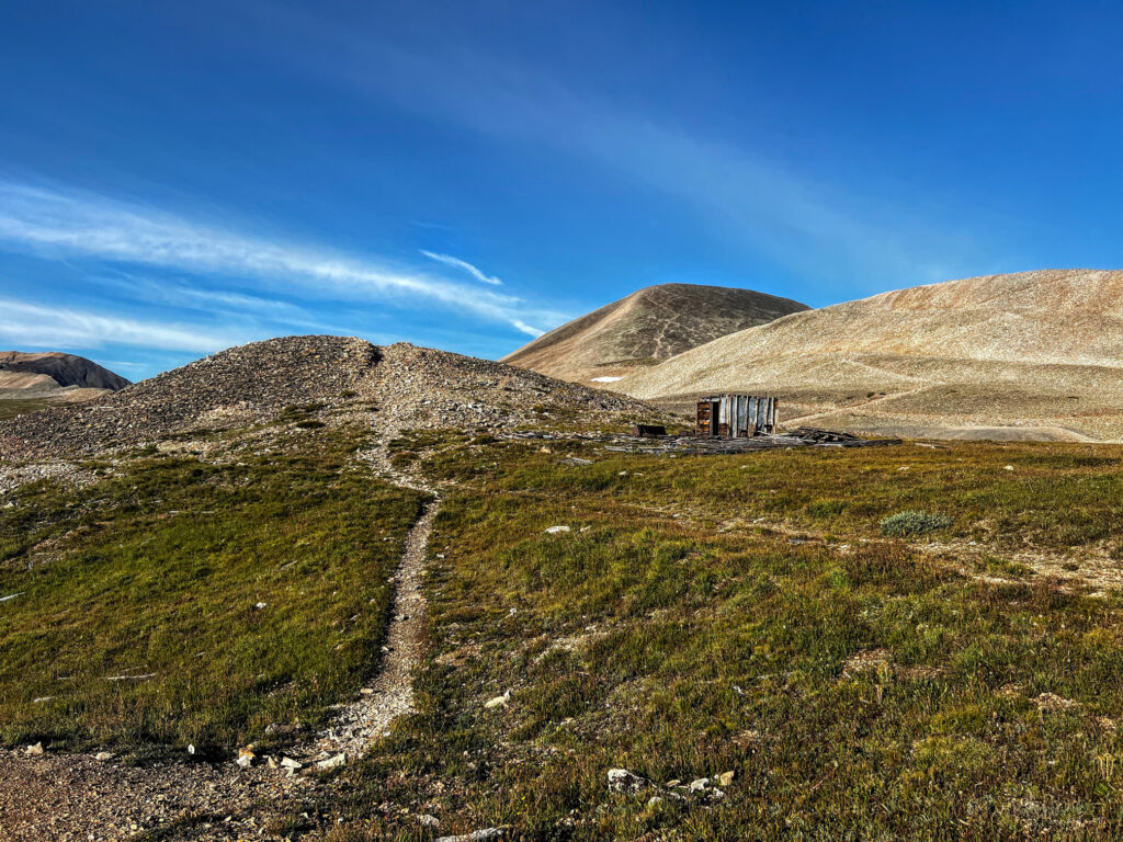
The area around Mount Sherman has a rich mineral mining history, with many remnants present along the ascent. Indeed, in the 1800s, residents of the town of Leavick worked in the area’s mines. The town mill, remnants of which are passed along Fourmile Creek Road, processed the ore. Though in the 1920s, the town had been mostly abandoned once the area mines had closed. Today, the mountain is still located on a mining claim operated by the Day Mining Company, though hiking is presently permitted.
As with nearly every Colorado 14er mountain, Mount Sherman is extremely popular especially because of its relatively mild ascent. Plan to hike on a weekday or arrive very early in the morning for less trail traffic.

Mount Sherman
- Summit Elevation: 14,036ft.
- Range: Mosquito
- Location: Pike National Forest
- Nearest Town: Fairplay / Leadville

Trail Guide
Route Information
- Route: Southwest Ridge
- Class: 2
- Type: Out-and-Back
- Trailhead: Fourmile Creek
- Trailhead Elevation: 12,189ft.
- Route Length: 4.81 mi.
- Elevation Gain: 1,847ft.
Route Overview
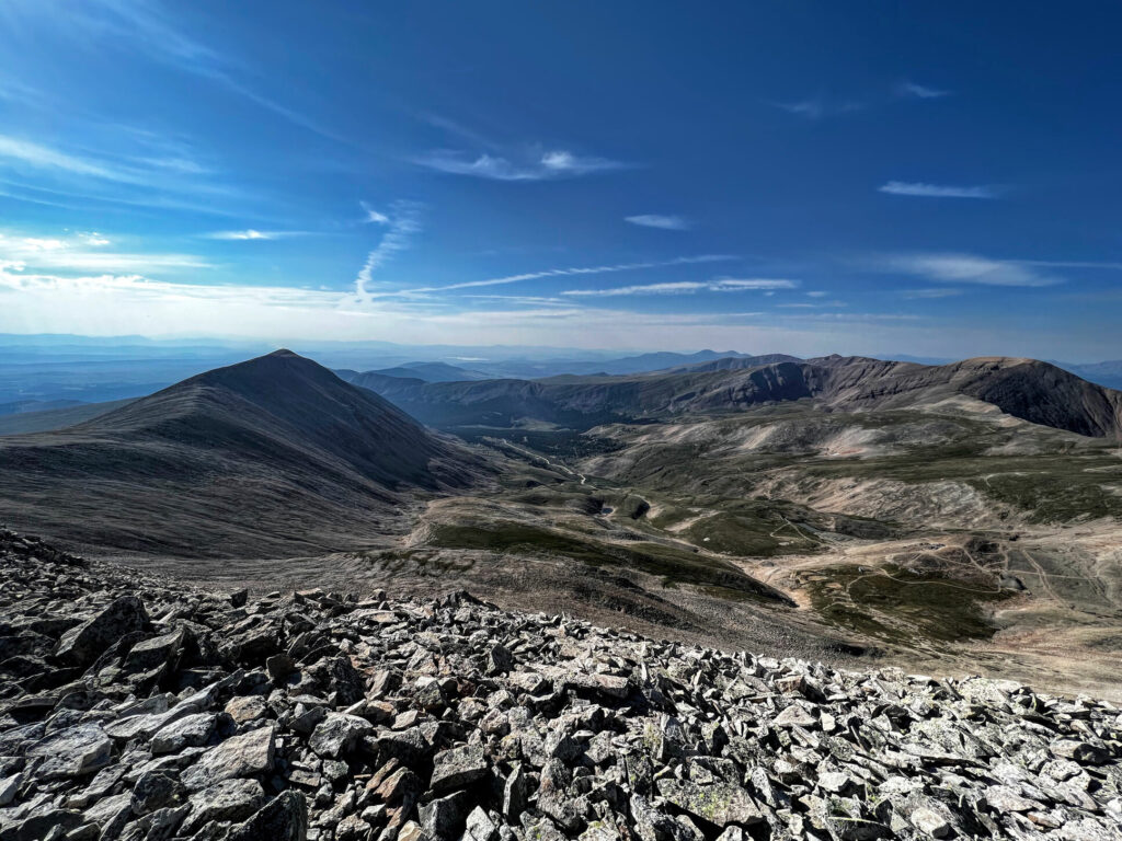
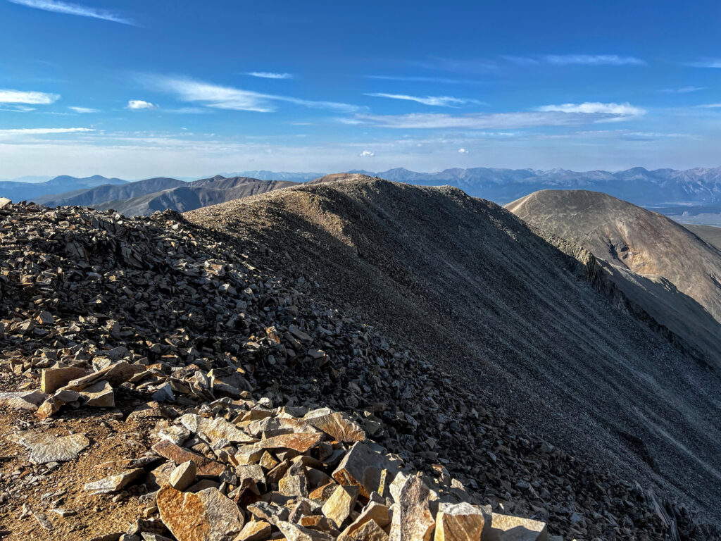
The Class 2 Southwest Ridge route to Mount Sherman begins at about 12,000ft. at the Fourmile Creek Trailhead parking area/gate on County Road 18. The trail follows the road past the gate and passes the remnants of Dauntless Mine, which mined for silver, on the west side of the trail. The route quickly reaches a junction; head right on the trail in an easterly direction into flats toward a few switchbacks and eventual ascent along the road/trail. Badger Boy Shaft and Rob Roy Shaft, both primarily uranium mining operations, are passed along the ascent.
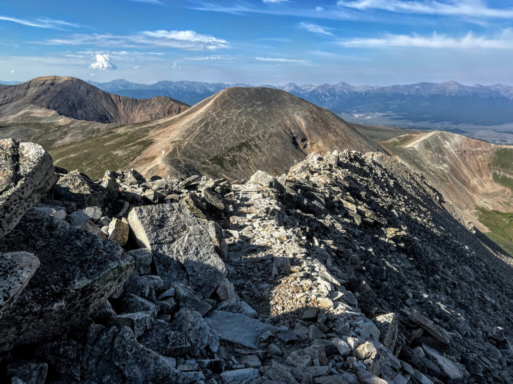
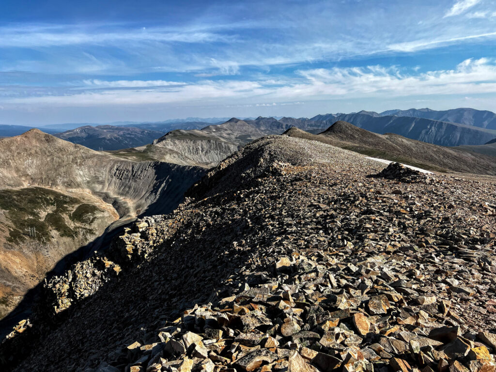
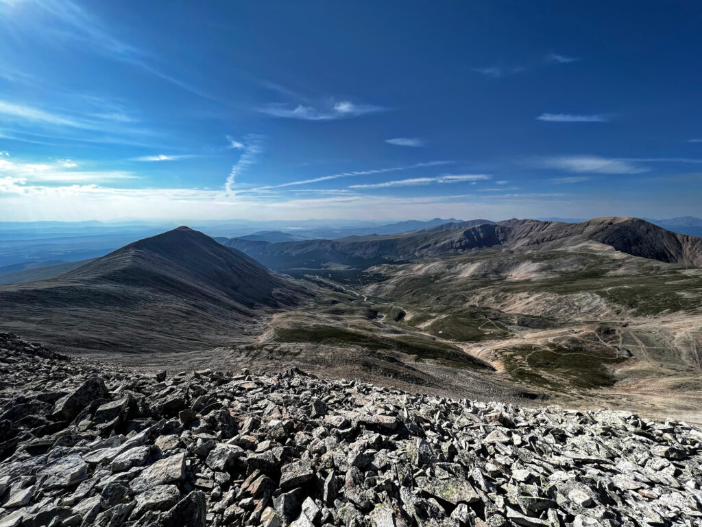
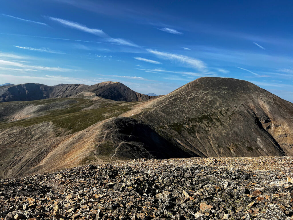
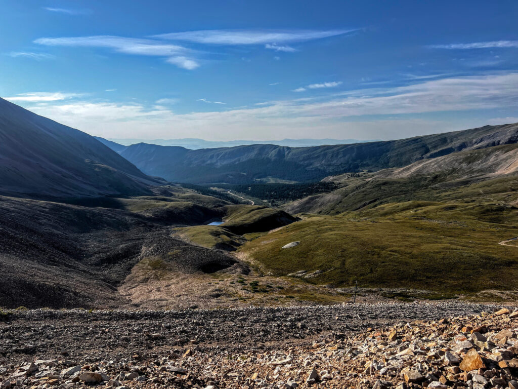
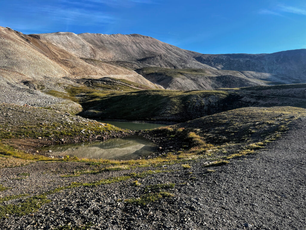
This part of the ascent offers great views into the valley and leads to remnants of the Hilltop Mine (which mined lead, zinc, and silver), a little over a mile into the route. Here the trail will start to steepen as it heads into loose talus toward the saddle between Mount Sheridan and Mount Sherman. Cairns will help guide the way along Mount Sherman’s southwest ridge. Reach a considerably exposed portion of the ridge near 13,600ft. and proceed with care on the loose rock. The remainder of the ascent is mellow toward the flat summit of Mount Sherman at 14,036ft. Be rewarded with excellent views of Mount Sheridan (13,748ft.) to the south and Gemini Peak (13,951ft.) and Dyer Mountain (13,862ft.) to the north. Double back for the descent and reach the Fourmile Creek Trailhead gate to complete the route.
Planning Tips
Getting There
From Fairplay, CO, head south on US 285 for a little over one mile. Turn right onto County Road 18, otherwise known as Fourmile Creek Road. Horseshoe Campground will be on the left about seven miles along County Road and Fourmile Campground is about a mile further. Reach the Leavick parking site just past an abandoned mill. In about another 1.5 miles, reach the Fourmile Creek Trailhead gate parking area.
Parking
You have a couple of options for starting the Southwest Ridge route to the summit of Mount Sherman. The shortest, and easiest approach, begins at about 12,000ft. at the gate on County Road 18 (i.e., Fourmile Creek Road). There is enough space for about 15-20 vehicles. Arrive early to get a spot here for a ~5 mile roundtrip hike. Though if the gate parking area is full, you could double back to find a spot along County Road 18. But the next best option is parking at the Leavick site, which is a parking area just past an abandoned mill on the west side of County Road 18. However, parking here will extend your hike to about 8 miles roundtrip.
Camping
There are some very convenient campsite options to choose from near the Fourmile Creek Trailhead. Fourmile Campground has 14 first-come, first-served sites and is about 20 minutes from the trailhead gate on County Road 18. Horseshoe Campground, which is also on County Road 18 and about 25 minutes from the gate, has 19 reservable sites which can be reserved in advance at recreation.gov.
Pets
Dogs are permitted on leash. There is some slight scrambling required to reach the summit of Mount Sherman, but most dogs should have no issue. If you do opt to bring your pet, please be considerate of others by keeping your pet on leash and picking up/packing out any dog waste.
Weather Forecast
Always check the weather forecast before venturing into alpine country. Thunderstorms and lightning are frequent occurrences in Colorado during the summer time. Plan ahead and if the weather does not look ideal, try your Mount Sherman 14er summit adventure for another day. Safety first!
RECOMMENDED HIKING APPAREL AND GEAR
Ten Essentials
When hiking in Colorado, you should always be prepared for sudden changes in weather, especially on 14er hikes. Therefore, you should carry the appropriate type and amount of gear, clothing, food, water, and other essentials. For certain, make sure that your packing list includes the Ten Essentials. It’s best to always be prepared!
Hiking Boots
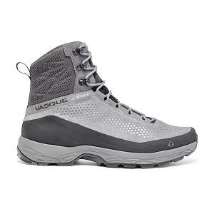
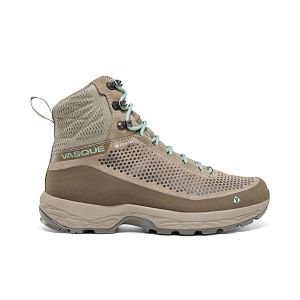
The Vasque Torre hiking boots are incredibly lightweight, provide excellent traction, and are quite affordable for their versatility. We like the Vasque Torre’s for everyday hiking that includes a bit of scrambling. In addition, with the “GORE-TEX” construction, you don’t have to worry about damp feet if the weather turns or you have to splash through streams or puddles along the way.
Hiking Pants
We love prAna’s hiking pants for their quality and versatility. Indeed, their Zion (for men) and Halle (for women) are great on- and off-trail, especially for travel. Constructed with a durable UPF-50 fabric, a water-repellant finish, and utility pockets, these have become a staple in our wardrobe. Remember that it can be rather chilly at alpine elevations, so consider hiking pants rather than shorts (both for warmth and sun protection).


Hiking Shirt
It can get chilly during alpine outings, particularly when you start early in the morning. Therefore, we typically opt for a long sleeve but lightweight shirt to keep us warm when it’s cold, but keeps us cool when we are working up a sweat later in the day. The no-cotton rule applies to shirts just as it does for pants and other articles of clothing.
Our preferred hiking shirt in the summer is Outdoor Research’s Echo Hoody because of its UPF sun protection qualities and lightweight (4oz.) breathable construction. The shirt has a hood for added neck protection and has thumbholes to protect your hands from sun exposure, if you opt to not wear sun gloves. Outdoor Research also makes different varieties of the Echo shirt (e.g., quarter zip, long sleeve without hood, t-shirt, etc.) if you prefer another style.


Insulated Jacket
The Arc’teryx Atom is easily our favorite insulated jacket. Yes, there may be lighter weight alternatives on the market, but we love the style, fit, packability, and function. Wear the Atom during early morning starts or when you reach the mountain summit. It’s a great addition to an outdoors wardrobe and comes in handy when the temperature dips.


Hiking Socks
For most of our hiking needs, we like Darn Tough socks over the multitude of options on the market. They last long and have an ironclad guarantee. In addition, Darn Tough has a variety of designs, ankle lengths, and cushioning options to choose from. We like the Hiker quarter length with light cushioning.


Headwear/Face Covering
We often wear a Buff as a neck gaiter to protect from the sun, given its UPF 50 protective construction. Buffs are also a great option to use as a face covering on the trail. In fact, there are 12+ ways of wearing a Buff, so it’s a versatile piece of gear.

Day Pack
To summit Mount Sherman, we like REI Co-op’s Flash 22L pack for its affordability, lightweight design, and overall versatility. This pack has enough storage for a day hike and side pockets are available to store Nalgene bottles or other equipment. It is also hydration reservoir compatible. We think the 22L version has the perfect capacity, though REI does have an even smaller Flash 18L with a drawcord top.

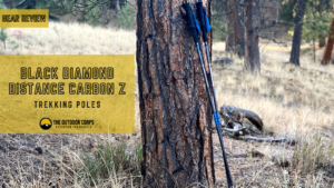
Trekking Poles
Although trekking poles are optional and a matter of preference, we prefer to use them for added stability. We recommend choosing the lightest weight poles your budget can afford. The Black Diamond Distance Z is our top choice due to its extremely lightweight construction. If you are seeking just one pole, rather than two, consider Gossamer Gear’s LT5, which can be purchased individually.

recommended books
We recommend bringing along a topographical map of the area, such as the “Leadville, Fairplay: National Geographic Trails Illustrated Map.” A good topographical map is always nice to have in addition to a GPS device, if you’re using one. In addition, we included a couple of our favorite field guides for plant and bird identification to aid in the enjoyment of your outdoor adventure. Lastly, we included Gerry Roach’s “Colorado’s Fourteeners: From Hikes to Climbs” guidebook, which is the best print guide available for hiking Colorado’s 14ers. It provides an amazing amount of information on Mount Sherman and other 14er hikes in Colorado that may be of interest.
- Colorado’s Fourteeners: From Hikes to Climbs
- A Climbing Guide to Colorado’s Fourteeners
- Leadville, Fairplay: National Geographic Trails Illustrated Map
- Rocky Mountain Wildflowers Field Guide
- Roadside Geology of Colorado
- Mammals of Colorado Field Guide
- American Birding Association Field Guide to the Birds of Colorado
- Sibley Birds West: Field Guide to Birds of Western North America
Disclosure: Please note that this post contains affiliate links. We may receive a small commission if you buy a product or service through an affiliate link. This revenue helps us provide readers with helpful content to plan amazing adventures.